Launches
Coming soon
Upcoming launches to watch
Launch archive
Most-loved launches by the community
Launch Guide
Checklists and pro tips for launching
Products
News
Newsletter
The best of Product Hunt, every day
Stories
Tech news, interviews, and tips from makers
Changelog
New Product Hunt features and releases
Forums
Forums
Ask questions, find support, and connect
Streaks
The most active community members
Events
Meet others online and in-person
Advertise
Subscribe
Sign in
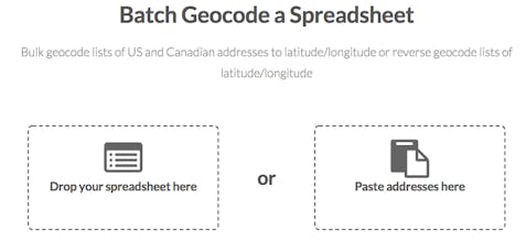
Geocodio
Convert Street Addresses into Map Coordinates
•
2 reviews
•
5 followers
Visit website
Follow
Overview
Launches
Reviews
Team
More
Blog
•
Newsletter
•
Questions
•
Forums
•
Product Categories
•
Apps
•
About
•
FAQ
•
Terms
•
Privacy and Cookies
•
X.com
•
Facebook
•
Instagram
•
LinkedIn
•
YouTube
•
Advertise
© 2025 Product Hunt
Do you use Geocodio?
I use this
I use something else
Recent Geocodio Launches
Geocodio+HIPAA
Ridiculously affordable, HIPAA-compliant geocoding
Launched on August 15th, 2018
3
25
Harvey Emergencies Map
Mapping rescue requests from Harvey victims
Launched on August 30th, 2017
0
78
Geocodio
Convert Street Addresses into Map Coordinates
Launched on January 21st, 2014
2
26
Geocodio Alternatives
Startup Stash
166 reviews
Startup financial planning
Streak
6 reviews
Mobile editing apps
The Stacks
0 reviews
Design inspiration websites
View all Geocodio alternatives
Review Geocodio?
5/5 based on 2 reviews
Leave a review
Reviews
Amedeo
•
2 reviews
Helpful
Share
Report
7yr ago
Paul Mendoza
•
2 reviews
Helpful
Share
Report
6yr ago